Today, we will cover techniques for landscape and urban visualization.
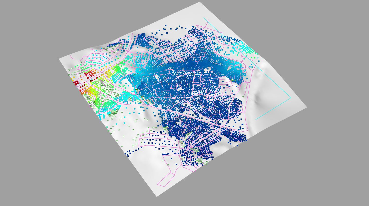
Part 1 – Urban Network Analysis (UNA)
Rhino Demo File Download: CLASS_11_UNA
Grasshopper File Download: CLASS_11_UNA_2
- English Help File: CityFormLab_UNA_ENG
- Korean Help File: CityFormLab_UNA_KOR
Reference: http://cityform.mit.edu/projects/una-rhino-toolbox
Part 2 – Image Sampler in Grasshopper
File Download: CLASS_11_IMAGE_SAMPLER
This definition uses an edited Navermap image of a site to visualize trees. HillShade data from Arcmap defines the height of the trees (shorter if in shade, taller if in light).
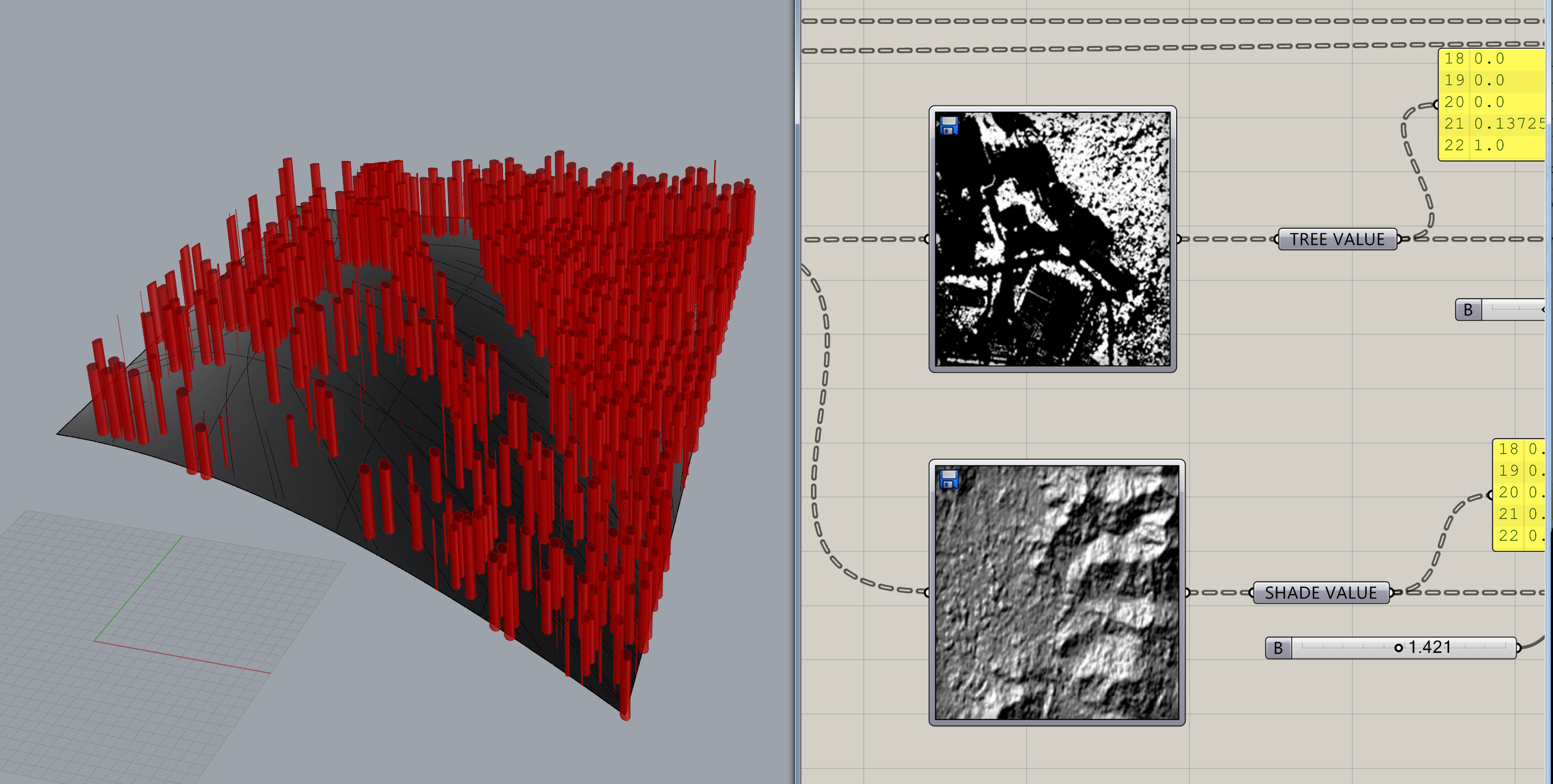
Preparing a Tree image to be imported into Grasshopper
- Open Navermap / Google Earth and locate your site.
- PrintSreen your site and open in Photoshop.
- As accurately as possible, crop this image to your 200m x 200m site, and edit Image Size to make it square.
- Using the Magic Wand Tool and adjusting the Tolerance value, with Contiguous unchecked we will select greenery in our site.
- Copy and paste the green areas into a new layer, and then turn off the original image and save as a new JPG file.
- Open the JPG file, and adjust saturation levels to 0 to make a black and white image, and invert the image so the trees are white and save.
- Save the PSD file as well in case of future editing.
*Grasshopper will read WHITE as +ve value and BLACK as –ve value, so we want the trees to be white.
Preparing a Hill Shade image to be imported into Grasshopper
- Download the HillShadeWM data file by clicking the ArcMap link under View In: http://maps.esrikr.com/arcgis/rest/services/HillshadeWM/ImageServer
- Open HillShadeWM.lyr file in ARCMap.
- Locate your site by also turning on a base map.
- In Layout View, File – Export Map and save as a JPG.
- In Photoshop, as accurately as possible, crop this image to your 200m x 200m site and edit Image Size to make it square.
- Edit the Levels to add some contrast and save as a JPG.
*Grasshopper will read WHITE as +ve value and BLACK as –ve value, so areas with SUN will have a higher value.
